Lyttelton Nooks and Crannies walk
- Image

- Image
- Image
- Image
- Image


-
Image
-
Image
-
Image
-
Image
-
Image
A great walk along some of the quieter roads and lanes of Lyttelton. It will take approximately one and a quarter to one and a half hours.
The time in brackets shows the approximate time into the walk so that you can decide if you want to turn and head to town and not finish the walk. Ask for a copy of the town map at the Information Centre before you set off.
Turn right out of Lyttelton Harbour Information Centre and head up to the top of Oxford Street until you get to the end of the cul-de-sac.
Follow the concrete path up the hill and then turn left up a grass track into the Anglican cemetery.
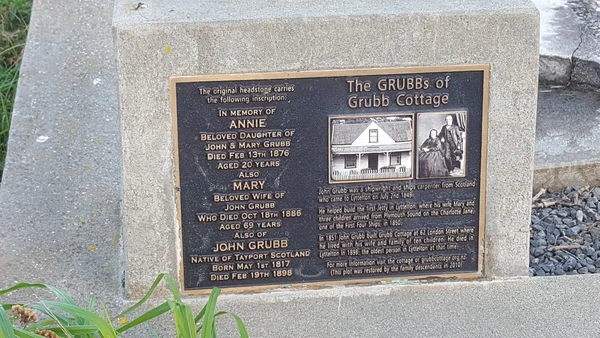
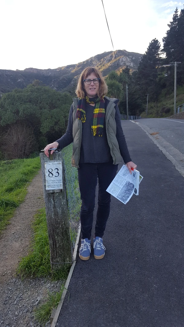
Once inside the cemetery head towards the big old pine tree on the left. At the wide grass track turn right and follow it through the cemetery. Look for the Grubb family grave on the left. Exit the cemetery and turn right, go past the barrier and cross over the road. Turn left and after about 20 metres turn right into the gap in the fence with a gravel walkway leading down to the right (the sign on the post says Footpath to 83).
Follow this and then go straight ahead up the concrete driveway. (25 Minutes) Turn right onto Cornwall Road and then the first left onto Upham Terrace. As the road loops back downhill it becomes Jacksons Road, continue down the road or down by the steps to the right. Ignore Keebles Lane to your left unless you want to return to town, (35 Minutes) and carry on straight ahead. At the fork in Jacksons Road take the lower path. Turn sharp left into Kenners Lane, down the steps and then left onto the road. At the end of Coleridge Terrace turn sharp right (do not go down the hill) and walk past the Lyttelton Top Club to the end of the street. Cross the road turn right and immediately take the second turning on the left which is Bridle Path Road. (45 minutes) Enjoy the scenery over the port to your left, but also check out the mural of the early settlers on your right.
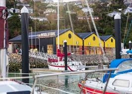
A wee way along take the lower road onto Cunningham Terrace. Walk past a white house on your left and go down the ramp and go down the zig-zag. (This area is known locally as Monkey Town; we think because there used to be a monkey puzzle tree growing there.) Turn right at the bottom and then down the short ramp on your left. Cross the road signposted to Governors Bay. At the next junction cross the main road again and head down Voelas Road. At the bottom take the steps in front of you to Te Ana Marina. Walk through the marina and head towards The Woolstore.. There are public toilets at the back of the building. Once you’ve walked the length of The Woolstore, follow the signs and footpath towards Lyttelton
Once back on Norwich Quay turn right and cross the main road at the crossing, turn left and walk up Dublin Street. Turn right onto London St and pass historic Grubb Cottage on your left – open to the public on Saturdays10.30 – 12.30.
Finish your walk with a relaxing stop at one of the cafes or bars on London Street. You may also enjoy exploring the unique Lyttelton shops on your way back.